Laboratory of Tree-Ring Research
Southwest Fire Tree-Ring Sites
 |
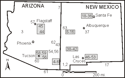
| Click on any shaded area to see some fire graphs of those sites (or hit the direct links below). |
Tucson Northern New Mexico El Malpais, NM
Southern New Mexico Northern Arizona
Southeastern Arizona Western New Mexico
 |
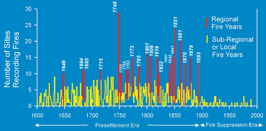
| This summary graph shows a relatively consistent frequency of
fire occurrence prior to 1900 (the "presettlement era") across
the 63 fire sites of the Southwest. Then, fire frequency
dramatically decreased at about beginning 1900.
Hypothesized reasons for the change in fire frequency at about 1900 are explained in these articles:
|
Laboratory of Tree-Ring Research, University of Arizona
Tucson, Arizona 85721 USA
Main Office: (520) 621-1608, Fax: (520) 621-8229
Comments to Paul Sheppard: sheppard @ ltrr.arizona.edu
Copyright © 2000-2013, Laboratory of Tree-Ring
Research, University of Arizona
Revised — April, 2013
URL: http://www.ltrr.arizona.edu/~sheppard/swland/firesites.html